Rajbiraj (Rājbirāj)
Rajbiraj (राजविराज) is a mid-sized municipality located in the south-eastern part of Madhesh Province of Nepal. Rajbiraj is the district headquarters of Saptari and is the eighth largest city in the province. The township of Rajbiraj was designed in 1938 based on influence from the Indian city of Jaipur - thus making it the first township in Nepal to receive urban planning. It was declared a municipality in 1959. According to the 2011 census, the city had a population of 37,738 but the latest population is estimated to be 69,803 making it the 33rd largest municipality in Nepal. The city area is spread over 55.64 km2 and comprises 16 wards.
The city is named after the ancient temple of Rajdevi, rebuilt by the Sena kings in the early 14th century. Rajbiraj has prominently served as a politically active town in the modern history of Nepal and has been the hometown to a number of icons of the nation. Rajbiraj comes under the Saptari 2(B) assembly constituency which elects a member to the Provincial Assembly of Madhesh Province once every five years and it is a part of the Saptari 2 constituency which elects its MP once in five years.
Roadways are the major mode of transportation to the town but it also has air connectivity. The major trade routes to the town are offered by the Nepalese metropolis of Biratnagar situated 78 km east to the city as well as the Indo-Nepal border of Kunauli situated 10 km south to the city.
Rastriya Janata Party Nepal's Shambhu Prasad Yadav and Sadhana Jha hold the current mayoral and deputy mayoral chairs of the town, as per the results of the local elections held on 27 September 2018.
Map - Rajbiraj (Rājbirāj)
Map
Country - Nepal
 |
 |
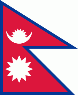
| Flag of Nepal | |
The name "Nepal" is first recorded in texts from the Vedic period of the Indian subcontinent, the era in ancient Nepal when Hinduism was founded, the predominant religion of the country. In the middle of the first millennium BC, Gautama Buddha, the founder of Buddhism, was born in Lumbini in southern Nepal. Parts of northern Nepal were intertwined with the culture of Tibet. The centrally located Kathmandu Valley is intertwined with the culture of Indo-Aryans, and was the seat of the prosperous Newar confederacy known as Nepal Mandala. The Himalayan branch of the ancient Silk Road was dominated by the valley's traders. The cosmopolitan region developed distinct traditional art and architecture. By the 18th century, the Gorkha Kingdom achieved the unification of Nepal. The Shah dynasty established the Kingdom of Nepal and later formed an alliance with the British Empire, under its Rana dynasty of premiers. The country was never colonised but served as a buffer state between Imperial China and British India. Parliamentary democracy was introduced in 1951 but was twice suspended by Nepalese monarchs, in 1960 and 2005. The Nepalese Civil War in the 1990s and early 2000s resulted in the establishment of a secular republic in 2008, ending the world's last Hindu monarchy.
Currency / Language
| ISO | Currency | Symbol | Significant figures |
|---|---|---|---|
| NPR | Nepalese rupee | ₨ | 2 |
| ISO | Language |
|---|---|
| EN | English language |
| NE | Nepali language |


